
#googlemapschallenge
The Google Maps Challenge — Longest Google Maps Driving Routes
contents
- 1 · The challenges
- 2 · Current records
- 3 · Updates to Google Maps
- 4 · Change for the worse
- 5 · Novelties, notions, blind spots
- 5.1 · No more kayak routes
- 5.2 · Going to South Africa?
- 5.3 · Darién Gap
- 5.4 · Other Google data munging and visualizations
- 5.5 · Mobile users
- 6 · Starting points
- 7 · Terminus station
- 8 · Challenge 1 — Longest leg
- 9 · Challenge 2 — Longest land route
- 10 · Challenge 3 — Longest land route with ferries
- 11 · Challenge 4 — Longest 3-point land route
Take a road trip to clear your mind. Take in a few sights and bring home a spoon or other collector's item.
According to Google Maps, how far could you go?
And the most pressing question: can you reach the sorrow at the world's end? Yes you can.
Each of the challenges below involves finding points A and B that yield the longest driving route in Google Maps. Each challenge has its own parameters, but certain rules apply to each challenge.
- the route A→B must be generated by the Google Maps algorithm—it cannot be manually adjusted
- the shorter of A→B and B→A must be used
- when multiple routes are available, the shortest must be used
- avoid highways and avoid tolls options must be off, except for the 3-point route challenge
- the "no ferry" land route may include a ferry to cross a river or any ferry shorter than 10 km
- the 3-point route cannot double back along the same path at any point on the route
- the route must be generated by typing in the waypoints, not by dragging them
Updates to Google Maps are frequent and unannounced — most of the routes are now historical artefacts. These will be marked as defunct routes.
This topic has been previously discussed on xkcd forums.
Entries updated 8 Sep 2022. The link to the 3-point route does not work for me — you'll need to enter the waypoints manually.
As Google Maps updates the routing network, some of the old routes are no longer available, or significantly shorter. This maps challenge page may therefore be out of date.
Don't be surprised if links to old routes show a significantly different (shorter) distance (old and new distance will be shown), or point to a route that no longer exists (noted as defunct route).
historical Thanks to a route by Dean Sych, the 30,000 km limit has been broken again. And how! By over 3,600 km. Thanks Dean!
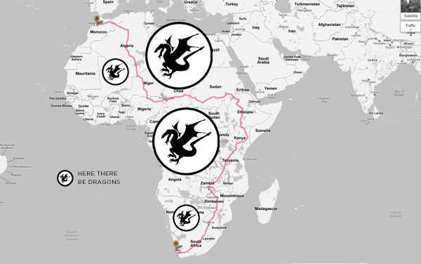
historicalPreviously, because of new routes through central Africa, route distances dropped by about 6,000 km. Whereas before routing avoided Congo and Algeria, they now go right through them. This made a lot of the 30,000+ km routes much shorter.
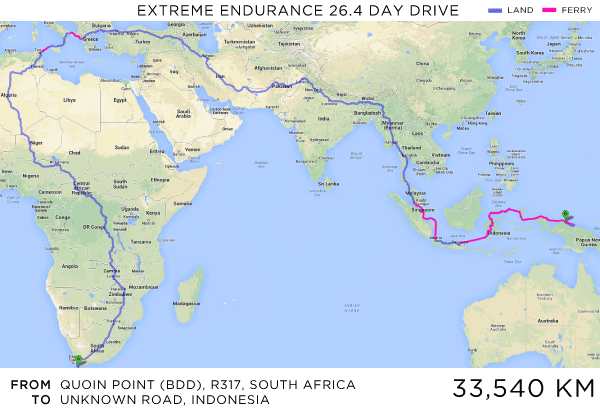
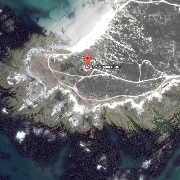
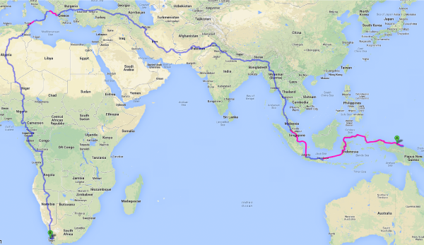
historical The longest route used to be 33,540 km from Quoin Point, South Africa to a dirt road in Indonesia. It starts with "Head northeast toward R317." and ends with "Turn left". After Malaysia, it's mostly ferries. Unfortunately, it's gone. Also, routing in Africa is now more optimized, shortening all the trips from south Africa.
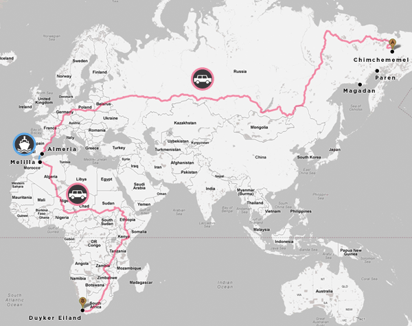
historical (Paren' no longer available as a destination) | The 30,000 km limit has been broken by a route from Paren' to Pearly Beach. This was furthered by discovering the bizarrely remote Chimchememel', Russia (from Chimchememel' to Danger Point).
historical (Uelen still not accessible) | The next milestone for a route with ferries is 32,000 km. Unless you have the money to build a road to Uelen, this new limit is a significant challenge. Interested individuals should start digging immediately.
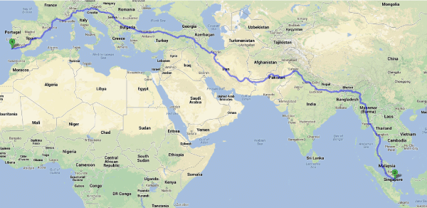
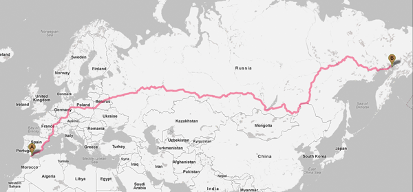
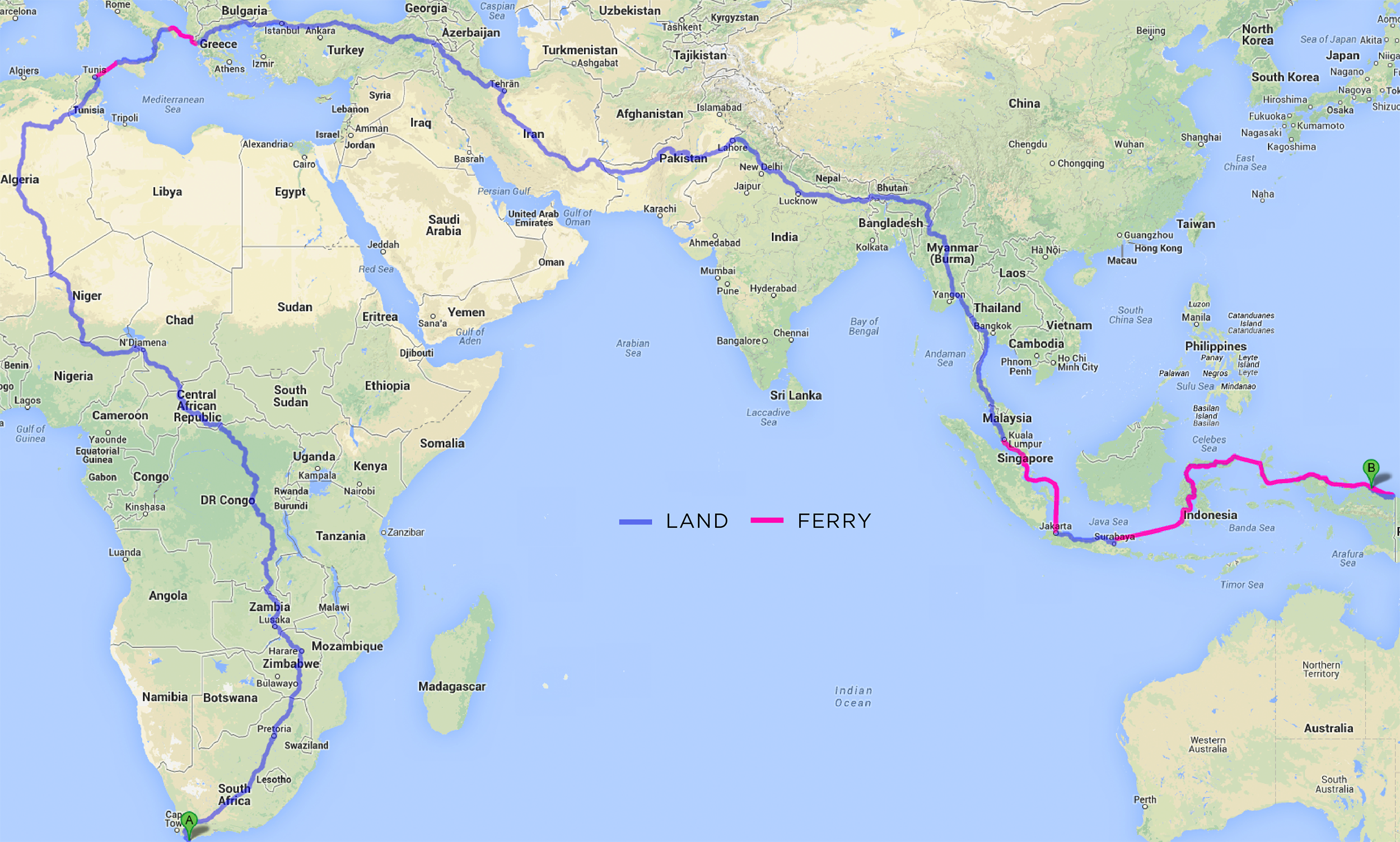
historical Many of the interesting past routes are now gone—the world is getting boring. This fun 191 hour drive from Portugal to Malaysia, shown below, is no longer available. Too bad. Stop off in Turkey to go to the bathroom. Pick up a few aluminum centrifuge tubes from Iran, too. That sounds like fun.
The details of the routing algorithm is the epitome of Rumsfeld's unknown unknown. It used to be that Portugal to Malaysia was a very doable and relaxing 8 day drive at 15,787 km. And you managed to avoid China.
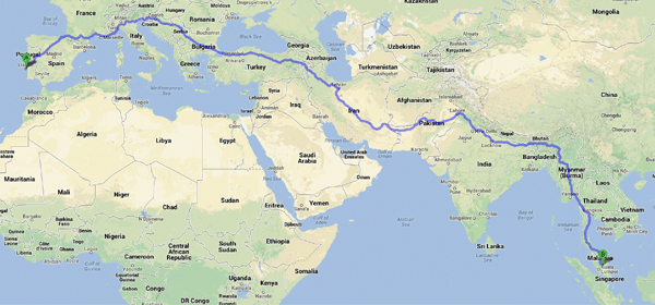
Later, the route included China but excludes Iran. Apparently, we're no longer on driving terms with Iran. If you want to go from Lisbon to Singapore, you no longer need your Iran for Dummies book.
Nevertheless, the updated routing was longer and burned more gas. Prius C drivers with advanced road endurance skills need apply. You know who you are.
If you play with routes in Google Maps you'll quickly notice that some parts of the world do not appear to be connected to the smarts of the routing algorithm. For example, you cannot drive from Bejing to New Delhi (As of 31 Aug 2015 this is no longer true. A 5,559 km route exists). These holes in the driving fabric pose a challenge in finding long routes.
historical Google's subtle humour can be found everywhere (though apparently not anymore, since kayaking has been removed from maps and replaced by decidedly un-funny flight routes), such as in step 9 of this Seattle to Hawaii route, which states "Kayak across the Pacific Ocean — 4,436 km". If you have endurance training, you might wish to continue kayaking to Tokyo, for another 6,243 km. For the purpose of this challenge, kayaking is not allowed.
These examples amply demonstrate that the internet was created by people with humor and is used largely by people without it. I say this because the kayak option has been removed. Doubtlessly because someone tried it, got hurt and the litigation lawyers got involved. It's always been the case that the 1% ruins it for the 99% of us.
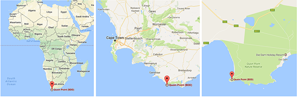
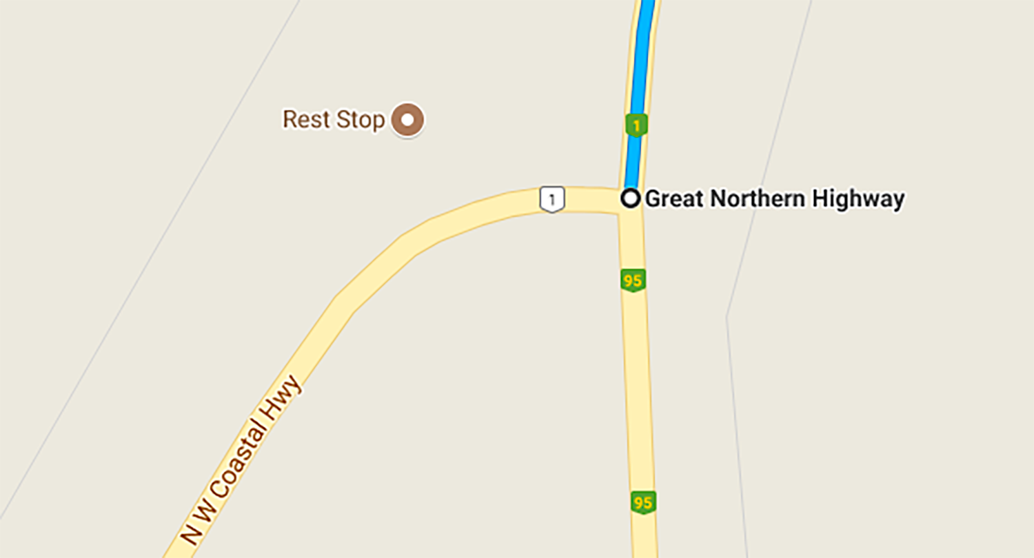
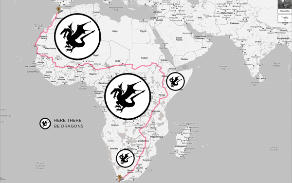
South Africa's Quoin Point is (or was, depending on the current routing) a common starting point for many of the routes. I'll have to visit this place next time I'm in South Africa and perhaps start driving north.
Some time ago, I recieved a note from Charlie Kelly who wrote to thank me for inspiring him to put together a list of what to do in South Africa. There's also Jenn's list of 100 Things to do in South Africa—she won't be upset if you just do 2 or 3.
No routes from North to South America exist because of this boggy marsh.
If you are interested in visualization and information, explore my global visualization of Google searches by language and find out where in the US people are searching in Chinese.
For the morbidly curious, of interest might be all the really stupid questions people ask Google.
Google Maps routes linked to from this page do not appear to work on iPhone's Safari browser (I have not tested iPad or iPod). A "driving direction not found" error appears. Rest assured, these routes do exist, and can be viewed on a browser on a PC or Mac. Weird.
The routes below are the current answers to the challenge. Do you have a better (longer!) route? Let me know.
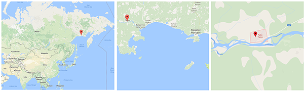
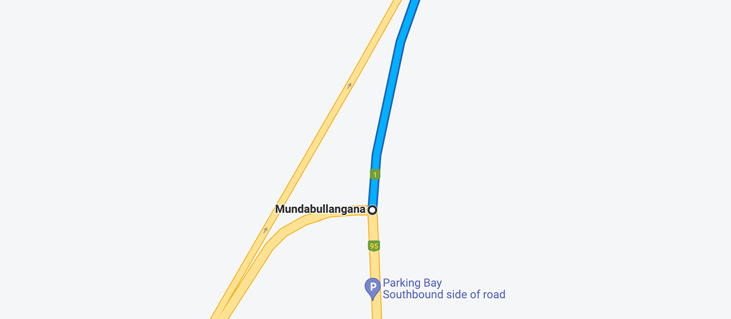
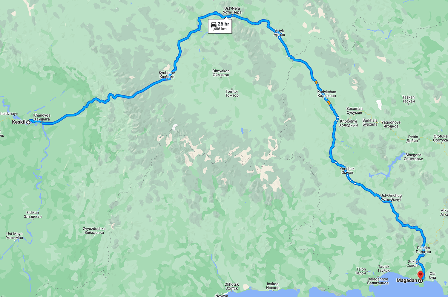
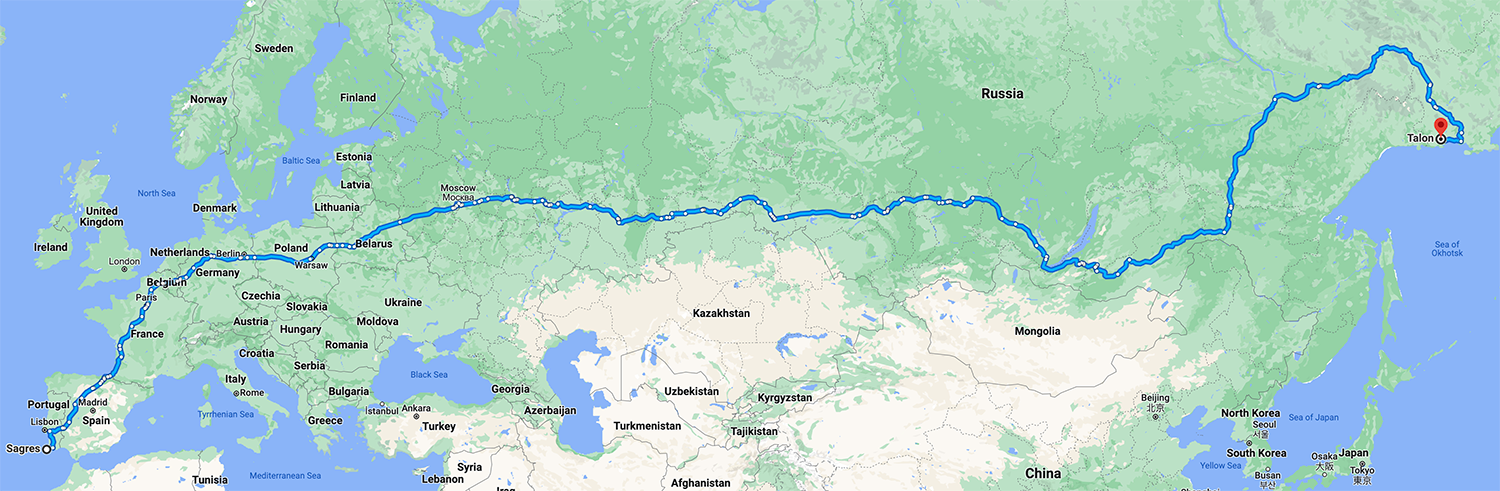
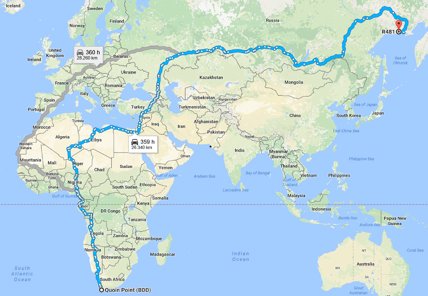
Talon is at the end of R481, which goes from Magadan to Talon. This road forks off the P-504 which runs for about 2,000 km from Manday to Magadan.
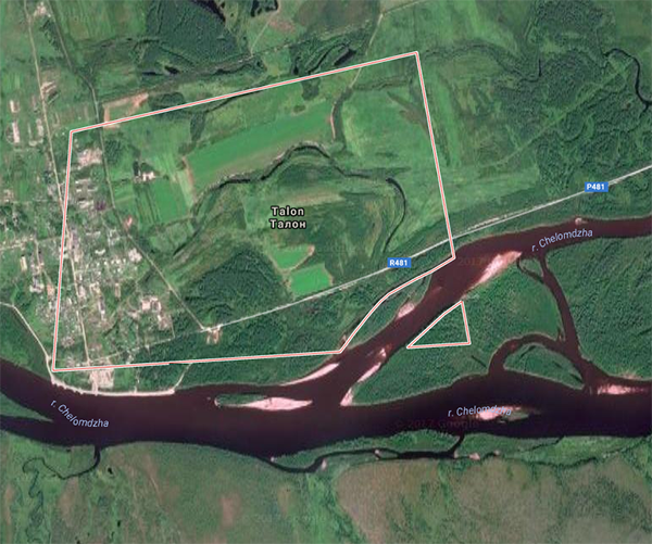
Thanks to James Robertson for finding this exhausting 2,121 km single leg trip. It's a route along Australia's National Highway between Kathernine Hot Springs (or alterinatively Katherine Funeral Services and (2,121 km later) a fork in the road that splits into the NW Coastal Highway.
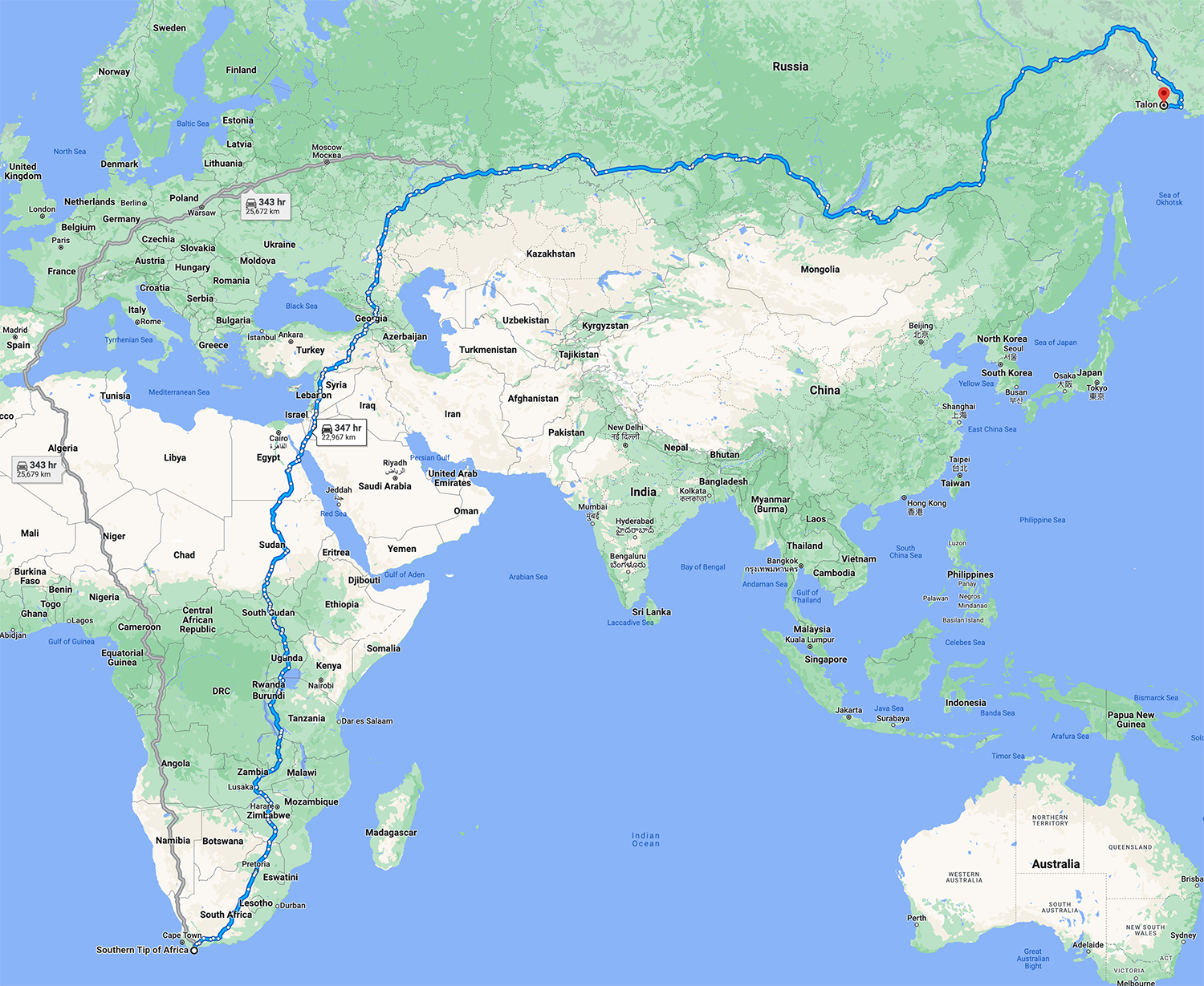
I'm sad to see that the route no longer includes Magadan, known as the sorrow at the world's end, which figured prominently as a destination in many of the routes.
On the upside, this route is so long that "Your destination is in a different time zone". Depending on which way you drive, this might save you an hour.
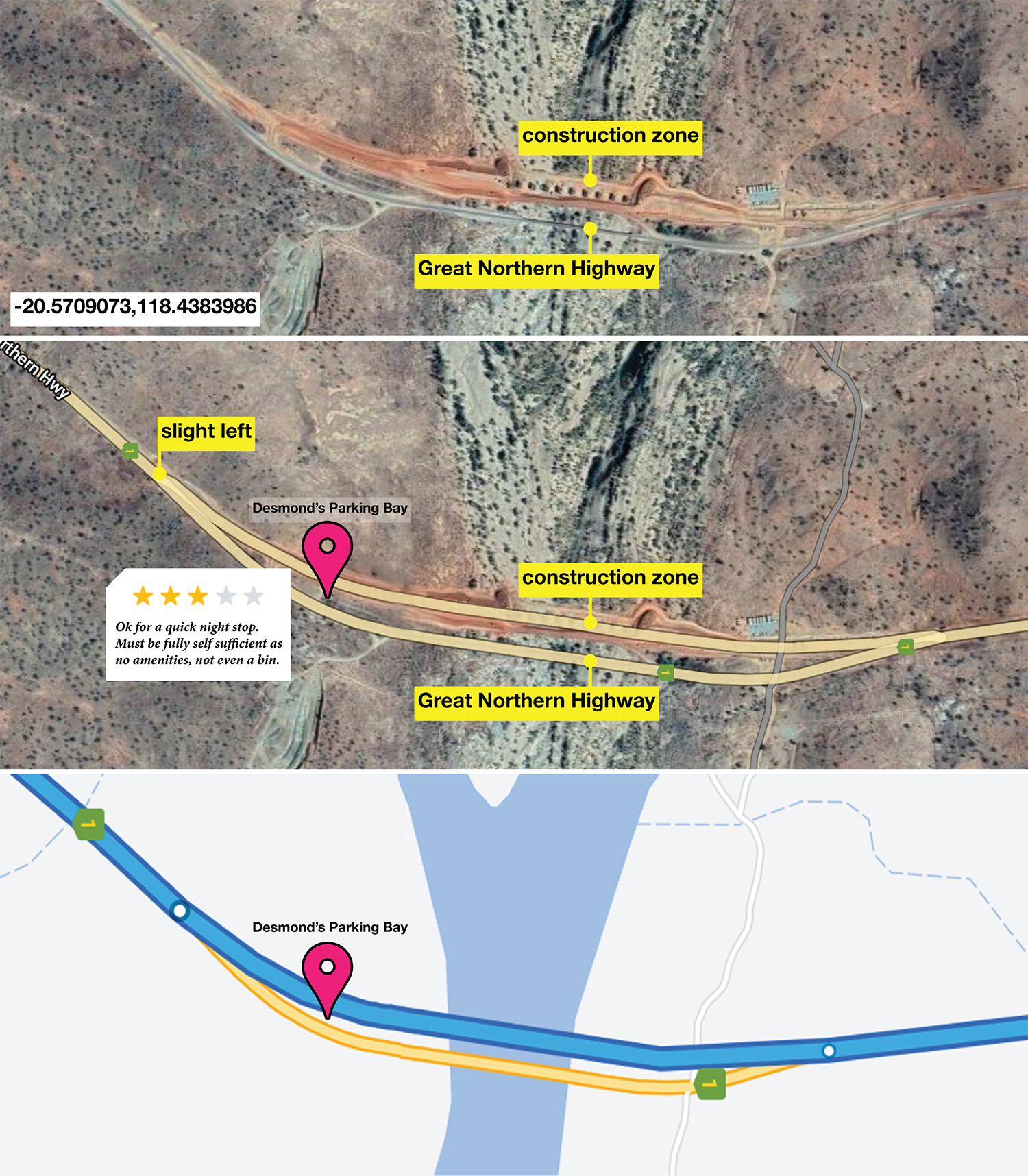
historical What happens when you get to the end of the route? You get a much deserved rest stop. Hilarious Aussie humor at its best. As of 7 Sep 2022,
The route now includes "slight left" as a step 1,440 km into the trip. While this technically breaks the longest leg condition, if you look closely, this is actually an incorrect cue. The road continues to the right and a slight left takes you into a construction zone where the bridge isn't complete (at the time the photo was taken). Make sure you bring a bin to Desmond's Parking Bay — and leave it there.
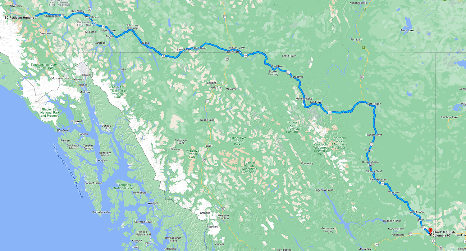
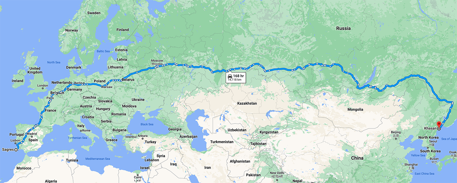
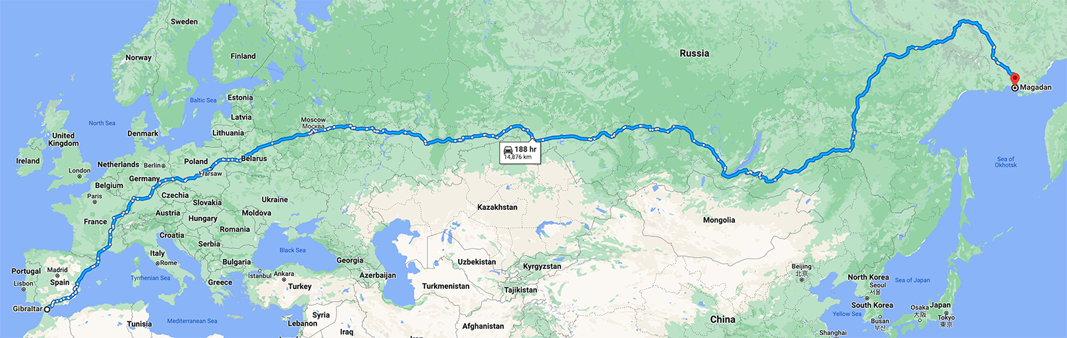
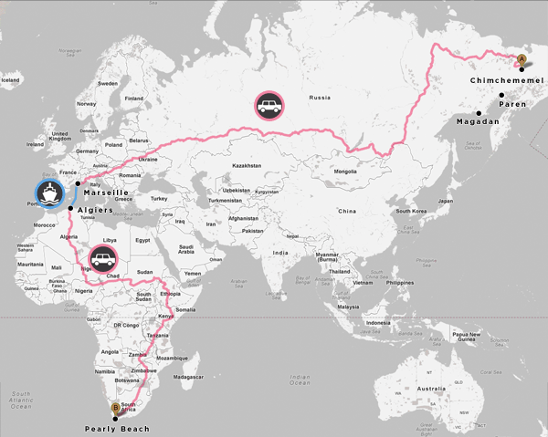
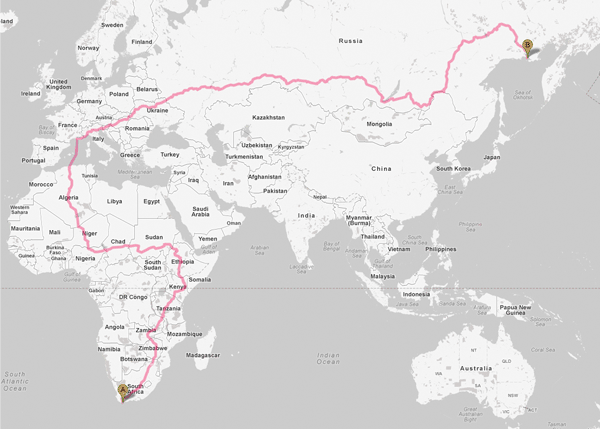
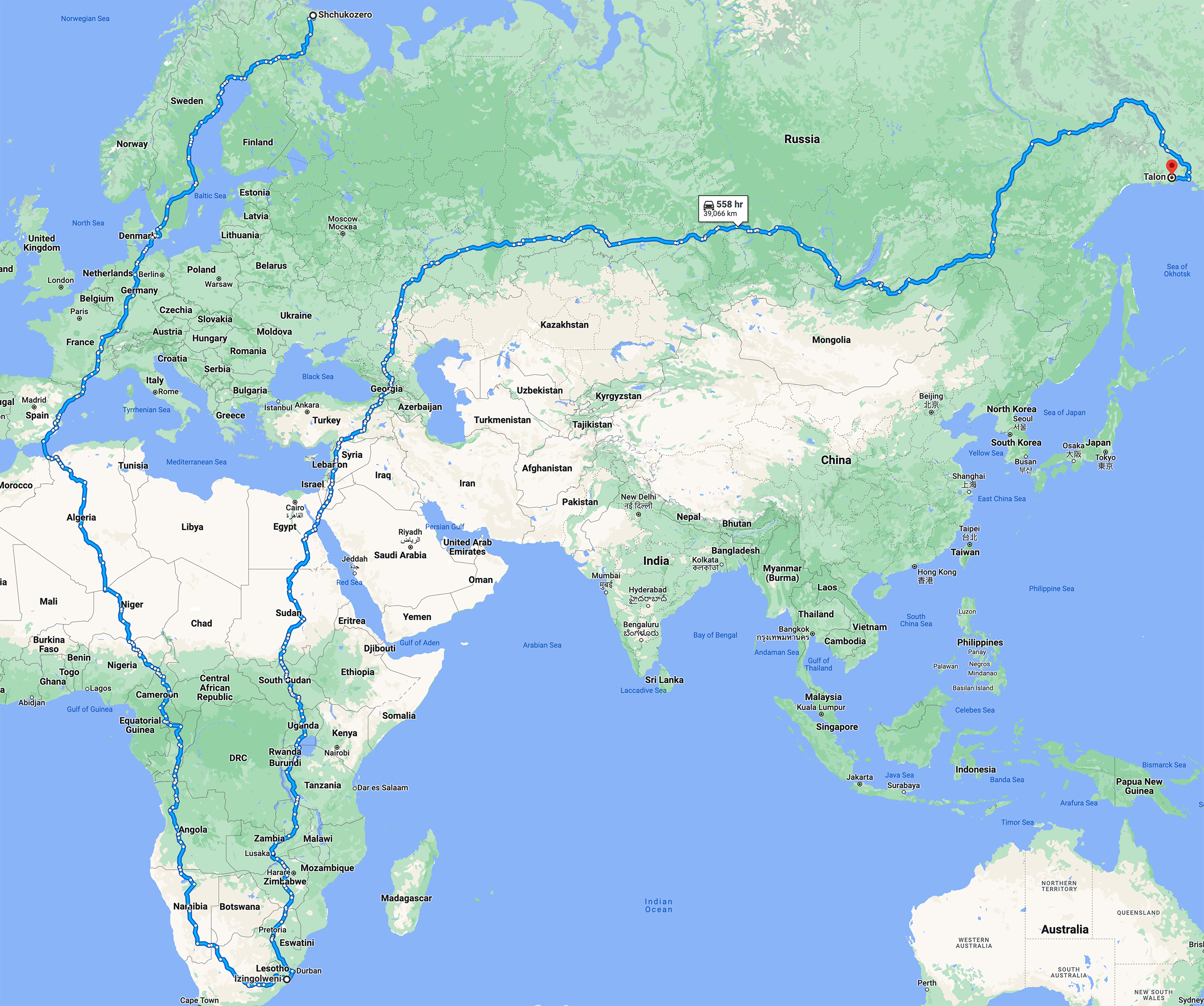
The longest Google Maps route that uses no ferries (or has a ferry that is < 10km) takes us from Sagres in Portugal to Talon in Russia. This route is so long that it goes beyond Magadan, affectionately known to be the sorrow at world's end. Thanks to Pieter Vandromme for submitting this route.
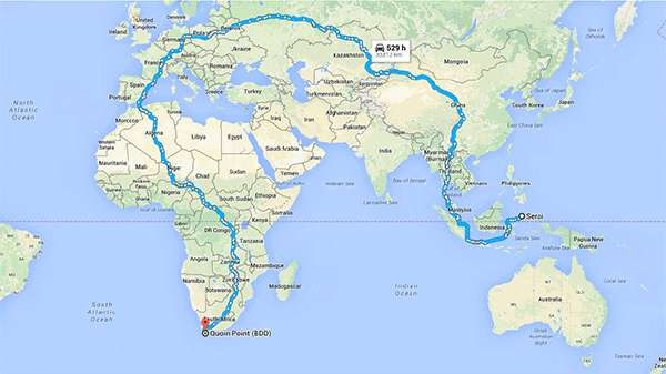
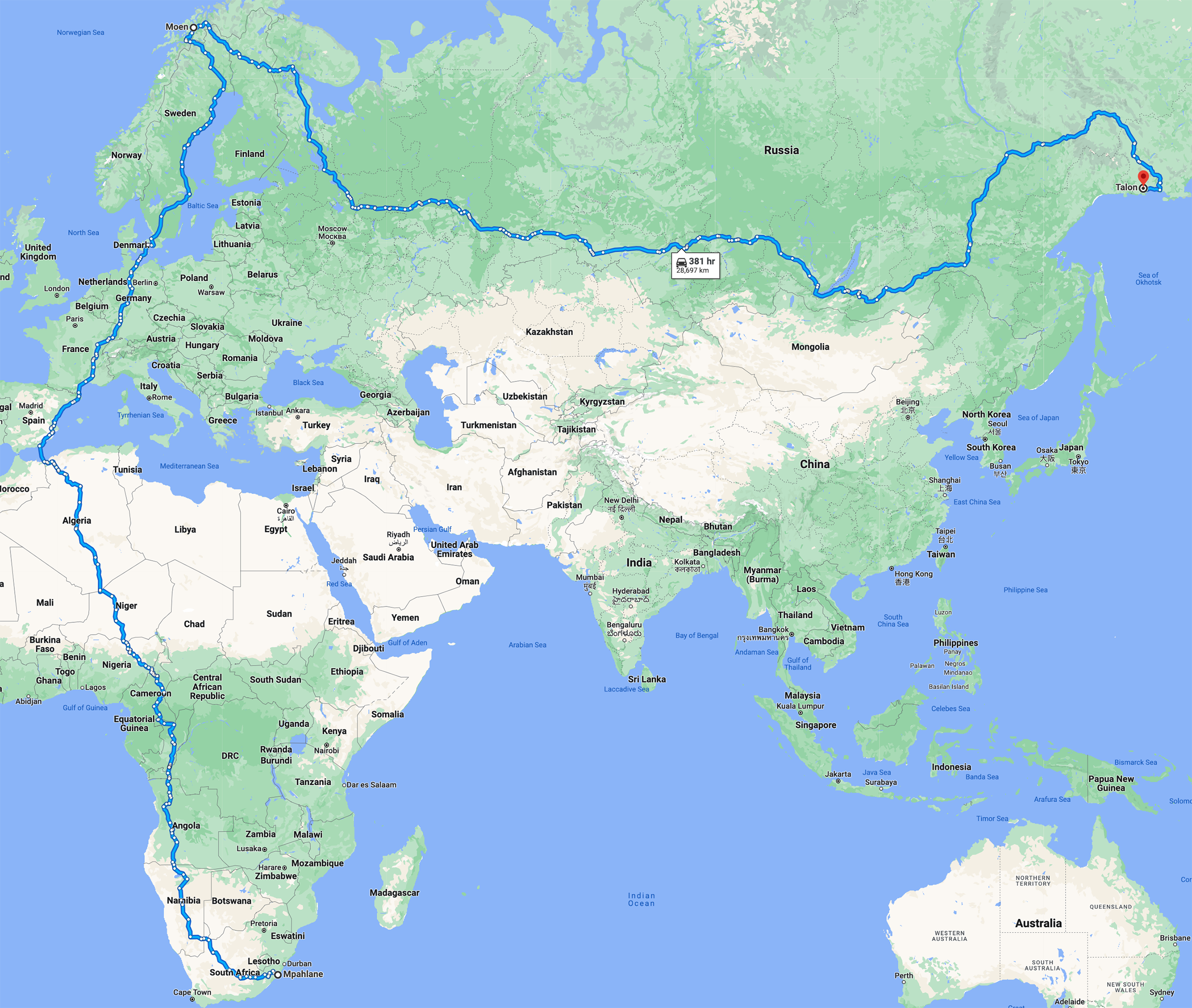
The longest Google Maps A–B route that uses ferries. The ferry distance cannot be more than 25% of the entire trip.
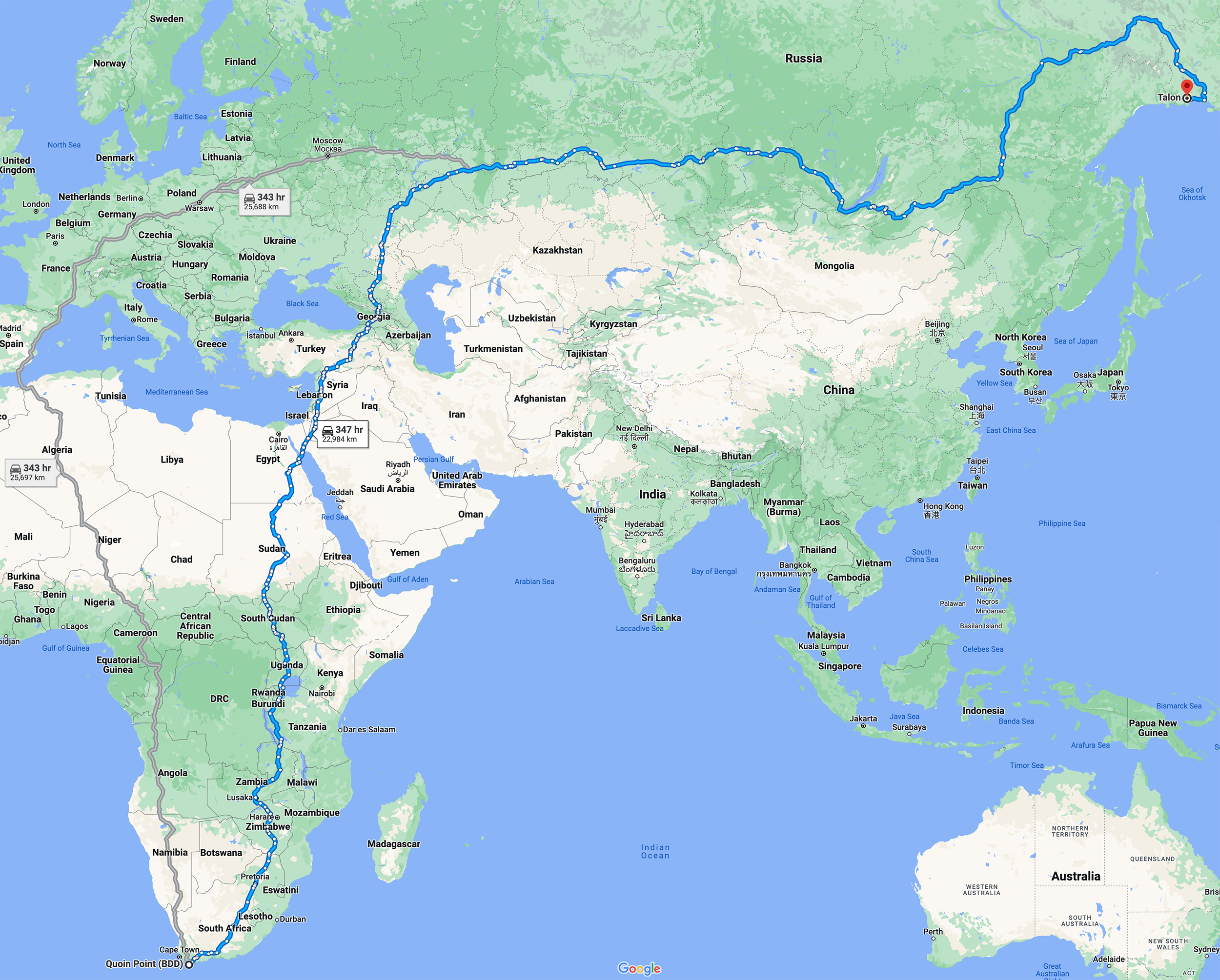
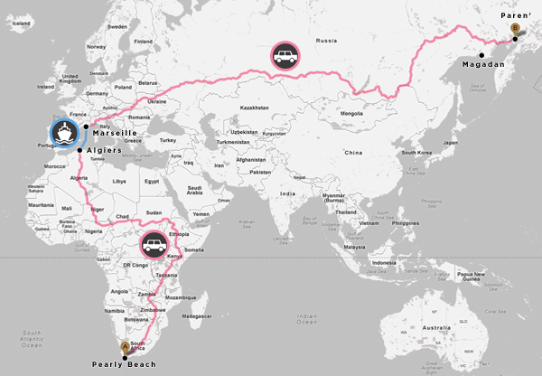
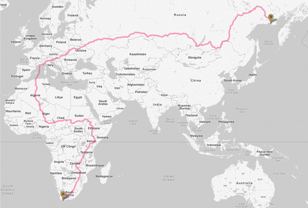
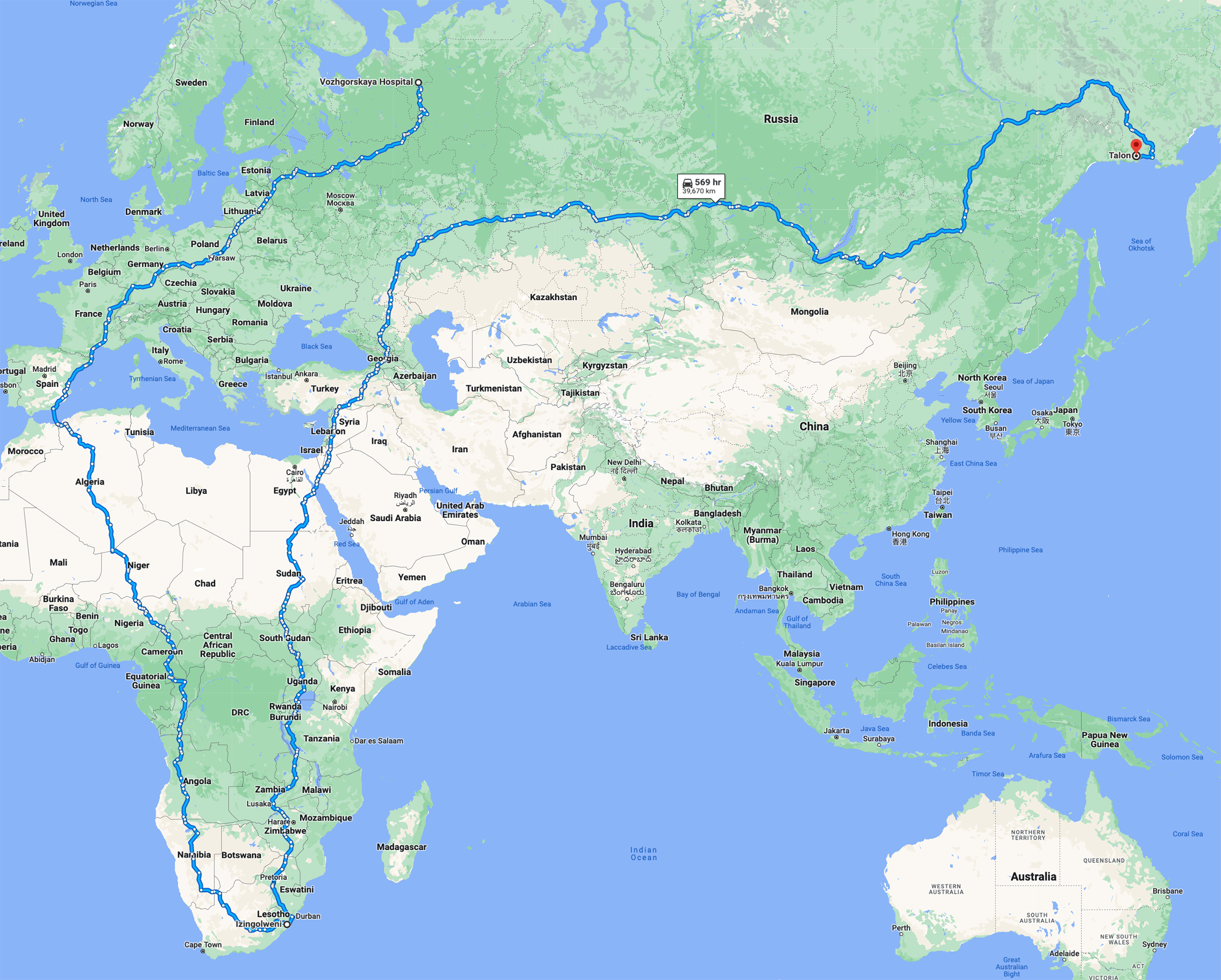
This is the mother of all routes — from one furthest place to another furthest place. The Southern Tip of Africa to Talon.
Talon is an interesting place. It is a “rural locality” with population 13 (as of 2016). Wikipedia indicates that “There is 1 street”. Yup, the one we're taking! It is also beyond the sorrow at world's end, which is Magadan.
When I explore this route, sometimes Google Maps returns an error that the route cannot be calculated and the route link does not work. You may need to enter the start and destination manually.
The 3-point route must be constructed by typing in the waypoints, not dragging them. No part of the route can double back on itself.
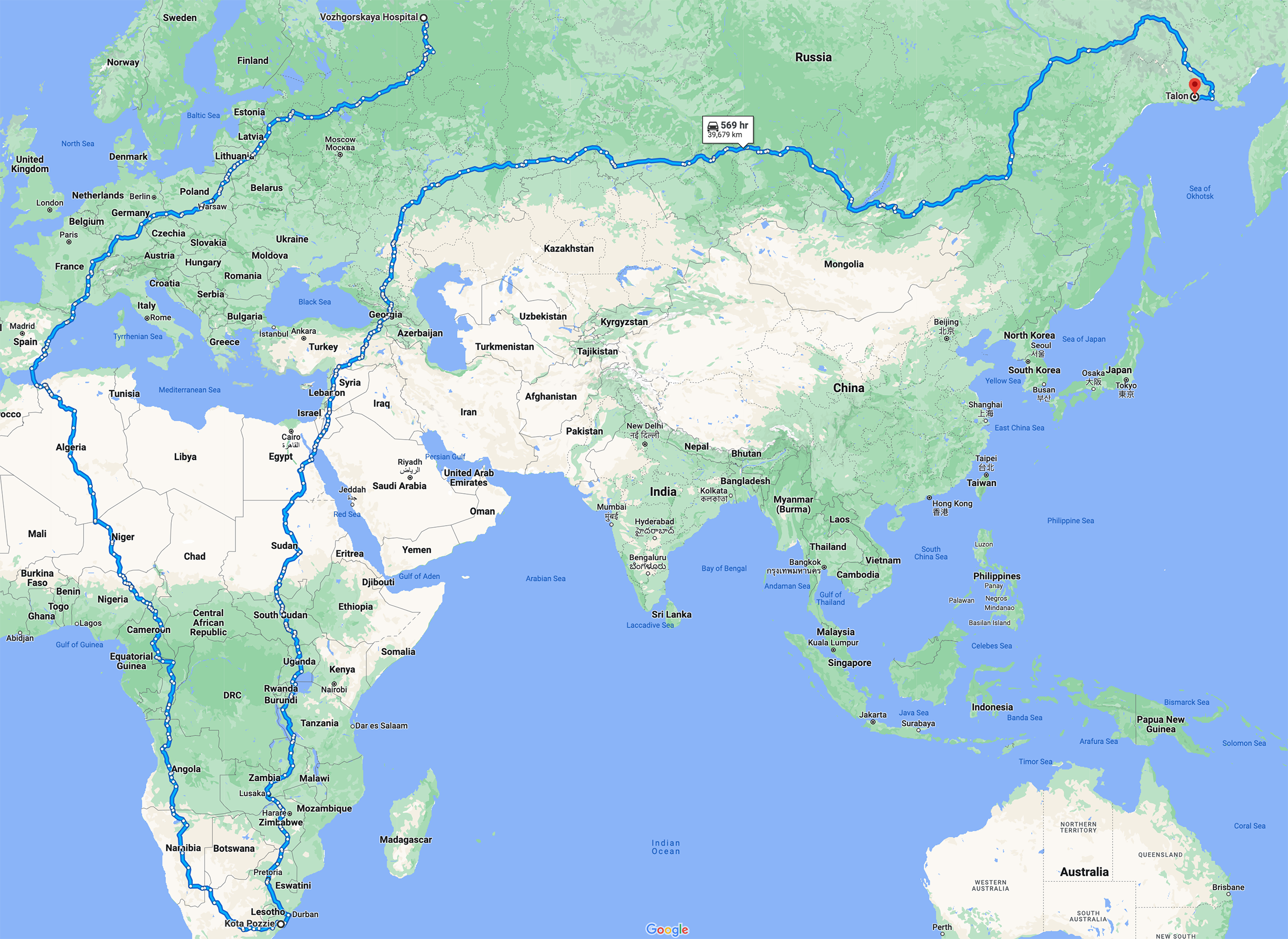
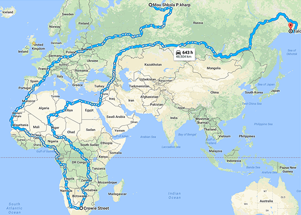
Thanks to Nico Tsaousis for suggesting the format of this challenge. Nico came up with the first entry (see v1 route below), a 31,377 km (at the time) route from an Unnamed Road in South Africa to Magadan via Norway.
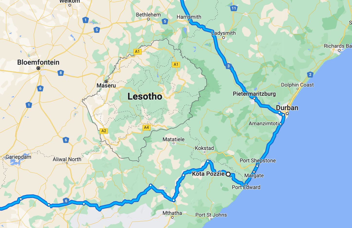
The current longest route in this category is a 39,679 km trip from a hospital in Arkhangelskaya Oblast via Kota Pozzi in South Africa to Talon in Russia.
Google's shortcut link to a 3-point route does not seem to work — a blank page is returned. You'll need to enter the addresses manually.
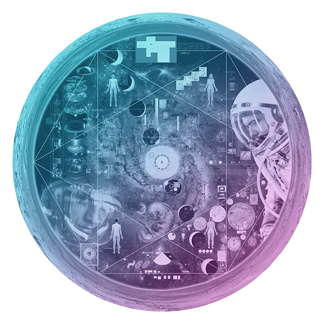
Nasa to send our human genome discs to the Moon
We'd like to say a ‘cosmic hello’: mathematics, culture, palaeontology, art and science, and ... human genomes.


Comparing classifier performance with baselines
All animals are equal, but some animals are more equal than others. —George Orwell
This month, we will illustrate the importance of establishing a baseline performance level.
Baselines are typically generated independently for each dataset using very simple models. Their role is to set the minimum level of acceptable performance and help with comparing relative improvements in performance of other models.
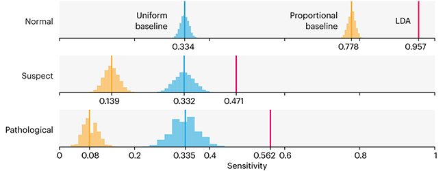
Unfortunately, baselines are often overlooked and, in the presence of a class imbalance5, must be established with care.
Megahed, F.M, Chen, Y-J., Jones-Farmer, A., Rigdon, S.E., Krzywinski, M. & Altman, N. (2024) Points of significance: Comparing classifier performance with baselines. Nat. Methods 20.
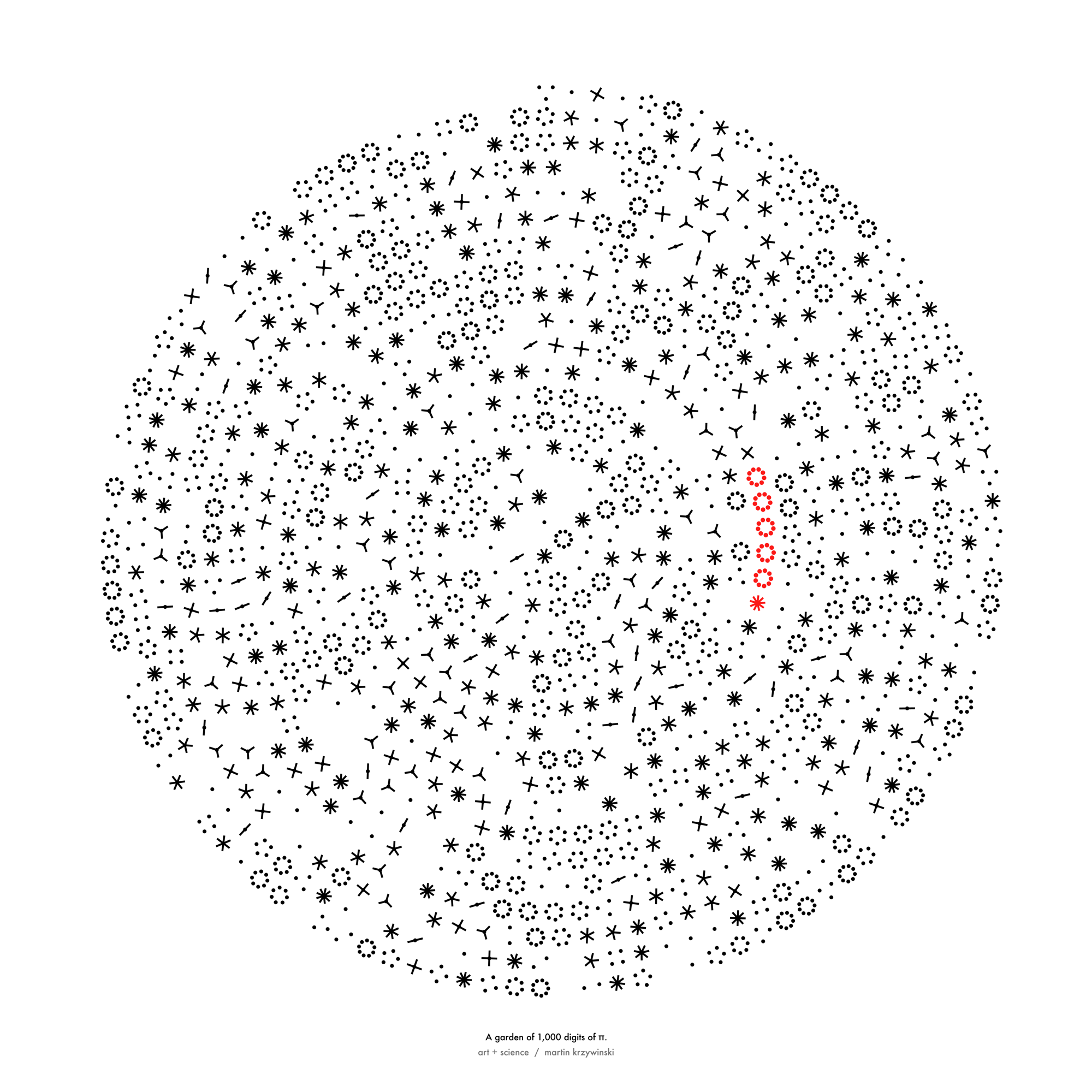
Happy 2024 π Day—
sunflowers ho!
Celebrate π Day (March 14th) and dig into the digit garden. Let's grow something.
How Analyzing Cosmic Nothing Might Explain Everything
Huge empty areas of the universe called voids could help solve the greatest mysteries in the cosmos.
My graphic accompanying How Analyzing Cosmic Nothing Might Explain Everything in the January 2024 issue of Scientific American depicts the entire Universe in a two-page spread — full of nothing.
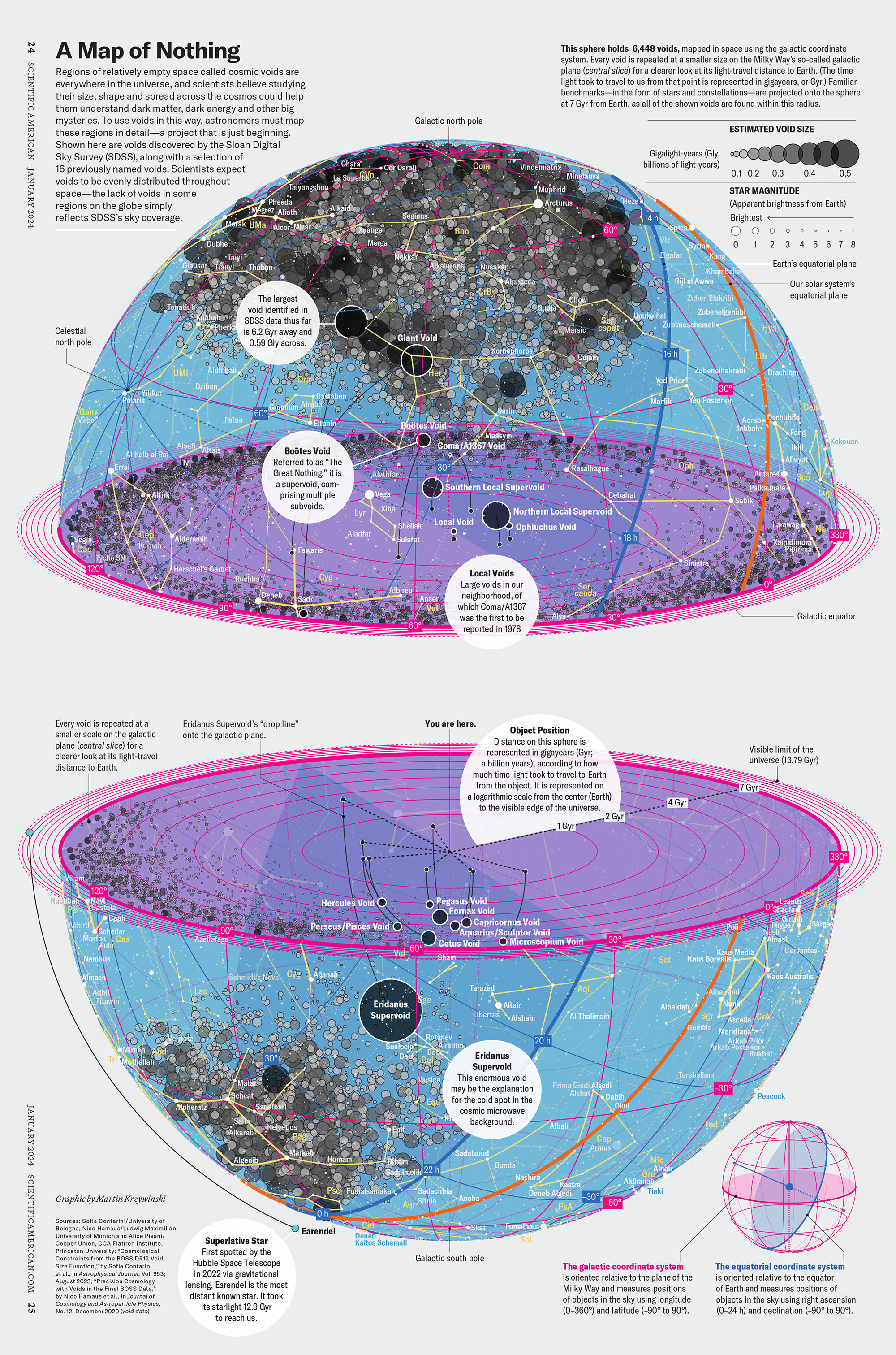
The graphic uses the latest data from SDSS 12 and is an update to my Superclusters and Voids poster.
Michael Lemonick (editor) explains on the graphic:
“Regions of relatively empty space called cosmic voids are everywhere in the universe, and scientists believe studying their size, shape and spread across the cosmos could help them understand dark matter, dark energy and other big mysteries.
To use voids in this way, astronomers must map these regions in detail—a project that is just beginning.
Shown here are voids discovered by the Sloan Digital Sky Survey (SDSS), along with a selection of 16 previously named voids. Scientists expect voids to be evenly distributed throughout space—the lack of voids in some regions on the globe simply reflects SDSS’s sky coverage.”
voids
Sofia Contarini, Alice Pisani, Nico Hamaus, Federico Marulli Lauro Moscardini & Marco Baldi (2023) Cosmological Constraints from the BOSS DR12 Void Size Function Astrophysical Journal 953:46.
Nico Hamaus, Alice Pisani, Jin-Ah Choi, Guilhem Lavaux, Benjamin D. Wandelt & Jochen Weller (2020) Journal of Cosmology and Astroparticle Physics 2020:023.
Sloan Digital Sky Survey Data Release 12
Alan MacRobert (Sky & Telescope), Paulina Rowicka/Martin Krzywinski (revisions & Microscopium)
Hoffleit & Warren Jr. (1991) The Bright Star Catalog, 5th Revised Edition (Preliminary Version).
H0 = 67.4 km/(Mpc·s), Ωm = 0.315, Ωv = 0.685. Planck collaboration Planck 2018 results. VI. Cosmological parameters (2018).
constellation figures
stars
cosmology
Error in predictor variables
It is the mark of an educated mind to rest satisfied with the degree of precision that the nature of the subject admits and not to seek exactness where only an approximation is possible. —Aristotle
In regression, the predictors are (typically) assumed to have known values that are measured without error.
Practically, however, predictors are often measured with error. This has a profound (but predictable) effect on the estimates of relationships among variables – the so-called “error in variables” problem.
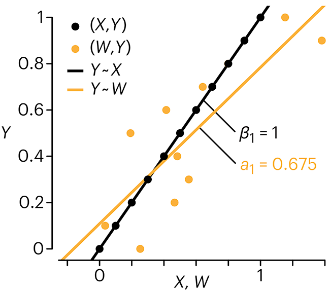
Error in measuring the predictors is often ignored. In this column, we discuss when ignoring this error is harmless and when it can lead to large bias that can leads us to miss important effects.
Altman, N. & Krzywinski, M. (2024) Points of significance: Error in predictor variables. Nat. Methods 20.
Background reading
Altman, N. & Krzywinski, M. (2015) Points of significance: Simple linear regression. Nat. Methods 12:999–1000.
Lever, J., Krzywinski, M. & Altman, N. (2016) Points of significance: Logistic regression. Nat. Methods 13:541–542 (2016).
Das, K., Krzywinski, M. & Altman, N. (2019) Points of significance: Quantile regression. Nat. Methods 16:451–452.
Convolutional neural networks
Nature uses only the longest threads to weave her patterns, so that each small piece of her fabric reveals the organization of the entire tapestry. – Richard Feynman
Following up on our Neural network primer column, this month we explore a different kind of network architecture: a convolutional network.
The convolutional network replaces the hidden layer of a fully connected network (FCN) with one or more filters (a kind of neuron that looks at the input within a narrow window).
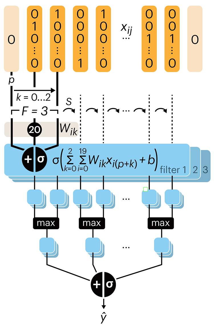
Even through convolutional networks have far fewer neurons that an FCN, they can perform substantially better for certain kinds of problems, such as sequence motif detection.
Derry, A., Krzywinski, M & Altman, N. (2023) Points of significance: Convolutional neural networks. Nature Methods 20:1269–1270.
Background reading
Derry, A., Krzywinski, M. & Altman, N. (2023) Points of significance: Neural network primer. Nature Methods 20:165–167.
Lever, J., Krzywinski, M. & Altman, N. (2016) Points of significance: Logistic regression. Nature Methods 13:541–542.